Tyndall Stone Quarry: Difference between revisions
No edit summary |
No edit summary |
||
| Line 4: | Line 4: | ||
[[File:Tyndall-Stone-Quarry-Development-Wiki-Page-Figure-1-Location-Map.jpg|thumb|Tyndall Stone Quarry]] | [[File:Tyndall-Stone-Quarry-Development-Wiki-Page-Figure-1-Location-Map.jpg|thumb|Tyndall Stone Quarry]] | ||
Tyndall Stone® is the registered trademark of the unique creamy buff or bluish grey mottled fossiliferous Ordovician dolomitic limestone that has been quarried at Garson, Manitoba. ([[Tyndall Stone Quarry|Full Article...]])</includeonly></onlyinclude> | |||
<!-- THE MAIN ARTICLE STARTS HERE --> | <!-- THE MAIN ARTICLE STARTS HERE --> | ||
Tyndall Stone® is the registered trademark of the unique creamy buff or bluish grey mottled fossiliferous Ordovician dolomitic limestone that has been quarried at Garson, Manitoba (Figure 1) for over 100 years, by Gillis Quarries Limited (and other companies). The stone, also known as “tapestry” stone due to its mottled or fern-like appearance, has been quarried for use in building and construction across Canada and around the World. According to Wallace (1927, p. 12), Tyndall Stone was “one of the most attractive building stones in Canada” and was “probably the best limestone for building purposes that Canada produces”. In the late 1920s, and up to 1931, the district of Garson was the largest centre of building stone in Canada (Goudge, 1933, p. 99). | |||
Tyndall Stone originated as a lime mud deposited in shallow, but relatively calm equatorial sea during the Upper Ordovician Period (445-450 million years ago), when what is now Manitoba, was located just south of the equator. The stone occurs as 2 to 3 foot thick, near horizontal beds within the Upper Mottled Limestone of the Selkirk Member of the Red River Formation The formation is present near the base of the Western Canada Sedimentary Basin, which lies above the Precambrian basement of the North American craton. | |||
The distinct mottling of Tyndall Stone is due to interconnected, branching and tubular (3 cm in diameter) brownish or greyish-brown dolomitic limestone that is present within a matrix of light buff or grey limestone. According to Kendall (1977), Coniglio (1999), and McCracken et al. (2007), many geologists believe that the mottles are trace fossils that represent preserved burrows possibly made by worms or crustaceans (as they foraged for food, or escaped from predators) in the soft lime mud that accumulated on the ancient sea floor. Coniglio (1999, p. 17) speculated that thalassinid shrimp, such as Callianassa (also known as the 'ghost shrimp' may have been the decapod crustacean responsible for the burrows (Figure 2). According to Goudge (1933, p. 100), the magnesian mottles consist mainly of tiny dolomite crystals cemented by sub-crystalline calcite. He noted that a tiny channel (worm boring) is present in the centre of each tubular mass. The burrows, filled with less dense material relative to the matrix, acted as conduits for magnesium-rich water that deposited the dolomite. The darker colour of the mottles relative to the matrix is due to oxidation of the trace amounts of iron and/or pyrite deposited with the dolomite (McCracken et al., 2007). | |||
Goudge (1933, p. 102) attributed the buff and the grey (or, blue) colour of Tyndall Stone) present in all of the quarries, as being due to oxidation and reduction of the rock due to groundwater flow along fractures and bedding planes (See: Figure 3). The grey (blue) limestone is the buried “reduced” stone, whereas the shallow buff limestone has been oxidized. | |||
Parks (1916, p. 100) and Goudge (1933, p. 102) noted the presence of large and well preserved white calcite fossils in Tyndall Stone. Receptaculitids, (an extinct group of uncertain affinities, possibly calcareous green algae) are the most common macrofossils. Solitary rugose corals (horn corals) are the second most abundant group. Other common fossils include: brachiopods bryozoans, gastropods, cephalopods, and trilobites; stromatoporoid sponges; colonial rugose and tabulate corals. Sections of echinoderms are the most abundant bioclasts (Young et al., 2013, p. 10). | |||
According to the Garson and District History Book Committee (1990, p. 15), it is believed that the Tyndall Stone was first discovered in the District of Garson by a farmer named Gunn who had dug a shallow water well (probably in Section 3, Township 13, Range 6 East) on a local rise in topography, known the “Hill” (looking from the west along PTH 44). The “Hill” is 2.4 km long by 0.8 km wide. The name of the stone was derived from the shipping point at Tyndall, Manitoba on the Canadian Pacific Railway, situated a short distance to the east of Garson (Figure 1). | |||
[[File:Tyndall-Stone-Quarry-Development-Wiki-Page-Figure-1-Location-Map.jpg|thumb|Figure 1: Tyndall Stone Quarry]] | |||
=Gunn’s Quarry= | |||
In 1894 (or possibly, 1898), the first quarries were opened in vicinity of Garson (Parks, 1916, p. 47). One of these was probably Gunn’s Quarry (Figure 1, Locality 5 (East)), in NW3-13-6E, owned by John Gunn & Sons, Winnipeg. The quarry was in operation in 1903, employing 30 quarry men. The main product of the quarry was lime produced in two draw kilns that can be seen, from the former route of PTH 44 (previously, the Trans-Canada Highway). The lime was shipped by rail on the same spur line servicing the Tyndall and Garson quarries (Wells, 1905, p. 40). By 1914, no quarrying was being done in Gunn’s Quarry, nor within a nearby second smaller quarry, by John Gunn & Sons (Parks, 1916, p. 57). In 1915, Gunn’s Quarry and nearby quarry was sold to August Gillis (Garson and District History Book Committee, 1990, p. 17). | |||
= | It is interesting to note that William R. Gunn, one of the sons of John Gunn attended Manitoba College (later, the University of Manitoba) and was the first graduate of that institute. | ||
The | |||
=Garson Quarry= | |||
In 1898, William Garson opened the Garson Quarry (Figure 1, Locality 4) in l.s. 3 and 4, 10-13-6E (Parks, 1916, p. 47). By 1903, the quarry (500 feet long, 250 feet wide and 70 feet deep) was owned and operated by the Garson Quarry Company of Winnipeg, employing 68 quarry men and 30 expert stone cutters. The quarry was equipped with 3 horse-powered derricks and steam-power derricks for loading stone and rubble into train cars, running on the same spur line as the Tyndall and other quarries. Ornamental shapes and pedestals were made on a steam-power lathe and lime was produced in 4 draw-kilns, according to Wells (1905, p. 38). Garson Quarry Company became very profitable in the following years, but in 1911 William Garson died from pneumonia; and the company went into debt that included a claim to John Gunn & Sons (Garson and District History Book Committee, 1990, p. 16, 208). | |||
In 1912, Peter Lyall Sr. of Peter Lyall and Sons Construction Co. Ltd. of Montreal assumed the debt of Garson Quarry Company; and re-opened the quarry in 1913, under the management of Northwest Quarries Co. Ltd. (Wallace, 1913). In 1916 the Garson Quarry was being operated by Wallace Sandstone Quarries, Limited of Nova Scotia, with Peter Lyall as company president. The name of the community was changed to Lyall from Garson from 1912 to 1927 to honour the company president (Garson and District History Book Committee, 1990, p. 16). In July 1914, Parks (1916, p. 53) visited the quarry and reported that 250 men were employed by the company. Equipment at the quarry included: channellers, drills, jackhammers, a compressor, 5 derrick and a Marion steam shovel. Also, on the property were 6 draw kilns, in which waste rock was converted into lime. Dressed stone was worked in 600 foot by 100-foot mill building with a crane gantry, cranes, gang saws, diamond saws, rubbing bed, planers, lathes, hammer machine, compressor and pneumatic rods. Power for the plant was obtained from the City of Winnipeg’s power plant at Pointe du Bois. Parks listed the following buildings, as being completed using the output of the quarry: | |||
*Royal Alexandra Hotel, Winnipeg. | |||
*Law courts, Winnipeg (part). | |||
*Saskatchewan Legislative Building, Regina (Parks, 1916, Plate I). | |||
*Presbyterian Church, Moosejaw | |||
*Sask. Court House and Land Titles building, Humboldt, Sask. | |||
*Armouries, Prince Albert, Sask. | |||
*Court house and Land Titles Building. Swift Current, Sask. | |||
*Registry Office. Fort William, Ont. | |||
*Post-office, Sault Ste. Marie, Ont. | |||
*Gaol and gaoler's house, Sault Ste. Marie, Ont. | |||
After Park’s 1914 visit, the mill building was extended by 70 feet and a double diamond saw, a drag diamond saw and 4 additional planers were added (Parks, 1916, p. 53). | |||
In February 1916, a major fire destroyed the Centre Block of the Canadian Parliament Buildings in Ottawa. Wallace Sandstone Quarries, Limited was contracted to supply stone in the reconstruction of the Centre Block. Tyndall Stone was used for the walls of corridors, entrance halls, main and first floors Commons and Senate Chambers; Confederation Hall and Hall of Honour (Lawrence, 2001, p.22). In 1917, the mill building was destroyed by fire and quarrying ceased (Mineral Inventory Card No. 966). | |||
In 1944, Louis Juravsky bought the Garson Quarry for back taxes and formed the Garson Limestone Co. Ltd., with his sons Sam and Mal. A plant was developed in an old icehouse; and they began shipping rubble to a paper mill in Kenora. Then, they began production of building stone using a channeling machine; and in 1962, with a diamond saw with 244 cm. diameter blade. This marked the first quarry use of a diamond saw in the Garson District, which greatly increased production (Bannatyne, 1988, p. 7). Architectural stone from the quarry was used in the Museum of Natural History in Regina. The quarry ceased production in 1969; and the property was sold to Gillis Quarries Limited in 1973 (Garson and District History Book Committee, 1990, p. 16; Mineral Inventory Card No. 966). | |||
It is interesting to note that William Garson was the father of Stuart Garson, Premier of Manitoba from 1942 to 1948. William Garson also was one of the pioneers who founded Winnipeg Hydro (Parks, 1916, p. 47). | |||
=Tyndall Quarry= | |||
Henry’s Quarry, the predecessor to the Tyndall Quarry (Figure 1, Locality 7) in the north 1/2 of NE3-13-6E was worked as early as 1903 by William Henry & Company of Tyndall. Dressed and rough building stone; fine rubble for concrete; dressed ornamental stone (for tombstones); and quick-setting quick lime (for mortar and plaster) were produced at the quarry. A spur line from the Canadian Pacific Railway mainline at Tyndall, Manitoba provided access to the quarry, according to Wells (1905, p. 38). | |||
In July 1914, Parks (1916) visited the Tyndall Quarry, which had been acquired from William Henry & Co. by the Tyndall Quarry Co. (a syndicate of 4 stone supply companies) – Oliver & Mason (40 men, Winnipeg); Menzies & McIntyre (25 men, Winnipeg); Winnipeg Stone Co. (30-35 men, Winnipeg); and Western Stone Co. (65 men, St. Boniface). After 3 years, Western Stone Co.’s interests were purchased by the three other partners (Garson and District History Book Committee, 1990, p. 17). And by June 1927, Oliver & Mason became the sole operator of the Tyndall Quarry (Wallace, 1927, p.13, 32). | |||
In 1933, the Tyndall Quarry was 950 feet long, east-west; with a maximum width of 400 feet. The active area at the west end of the quarry was 270 feet square and was worked to a depth of 22 feet. The quarry had a capacity of 50,000 cubic feet of stone per month. Eighty men were employed during the quarrying season including 25 quarrymen (Goudge, 1933, p. 122). | |||
Around 1944, the Tyndall Quarry was 1,000 feet long, east-west; with a maximum width of 350 feet. The quarry was worked by channelling machines; and blocks of stone shipped to the company’s stone-dressing plant at 1591 Erin Street in Winnipeg for cutting and carving or directly to stone-dressing plants in other cities. According to Goudge (1944, p. 23), earlier lime production from waste rock had ceased; and the ruins of the battery of stone kilns could be seen at the east end of the quarry. Tyndall Quarry Co. ceased operation in 1957, after the death of Dave Oliver (Garson and District History Book Committee, 1990, p. 19). | |||
=Early Maneuvering= | =Early Maneuvering= | ||
Revision as of 22:11, 22 February 2021
Tyndall Stone® is the registered trademark of the unique creamy buff or bluish grey mottled fossiliferous Ordovician dolomitic limestone that has been quarried at Garson, Manitoba (Figure 1) for over 100 years, by Gillis Quarries Limited (and other companies). The stone, also known as “tapestry” stone due to its mottled or fern-like appearance, has been quarried for use in building and construction across Canada and around the World. According to Wallace (1927, p. 12), Tyndall Stone was “one of the most attractive building stones in Canada” and was “probably the best limestone for building purposes that Canada produces”. In the late 1920s, and up to 1931, the district of Garson was the largest centre of building stone in Canada (Goudge, 1933, p. 99).
Tyndall Stone originated as a lime mud deposited in shallow, but relatively calm equatorial sea during the Upper Ordovician Period (445-450 million years ago), when what is now Manitoba, was located just south of the equator. The stone occurs as 2 to 3 foot thick, near horizontal beds within the Upper Mottled Limestone of the Selkirk Member of the Red River Formation The formation is present near the base of the Western Canada Sedimentary Basin, which lies above the Precambrian basement of the North American craton.
The distinct mottling of Tyndall Stone is due to interconnected, branching and tubular (3 cm in diameter) brownish or greyish-brown dolomitic limestone that is present within a matrix of light buff or grey limestone. According to Kendall (1977), Coniglio (1999), and McCracken et al. (2007), many geologists believe that the mottles are trace fossils that represent preserved burrows possibly made by worms or crustaceans (as they foraged for food, or escaped from predators) in the soft lime mud that accumulated on the ancient sea floor. Coniglio (1999, p. 17) speculated that thalassinid shrimp, such as Callianassa (also known as the 'ghost shrimp' may have been the decapod crustacean responsible for the burrows (Figure 2). According to Goudge (1933, p. 100), the magnesian mottles consist mainly of tiny dolomite crystals cemented by sub-crystalline calcite. He noted that a tiny channel (worm boring) is present in the centre of each tubular mass. The burrows, filled with less dense material relative to the matrix, acted as conduits for magnesium-rich water that deposited the dolomite. The darker colour of the mottles relative to the matrix is due to oxidation of the trace amounts of iron and/or pyrite deposited with the dolomite (McCracken et al., 2007).
Goudge (1933, p. 102) attributed the buff and the grey (or, blue) colour of Tyndall Stone) present in all of the quarries, as being due to oxidation and reduction of the rock due to groundwater flow along fractures and bedding planes (See: Figure 3). The grey (blue) limestone is the buried “reduced” stone, whereas the shallow buff limestone has been oxidized.
Parks (1916, p. 100) and Goudge (1933, p. 102) noted the presence of large and well preserved white calcite fossils in Tyndall Stone. Receptaculitids, (an extinct group of uncertain affinities, possibly calcareous green algae) are the most common macrofossils. Solitary rugose corals (horn corals) are the second most abundant group. Other common fossils include: brachiopods bryozoans, gastropods, cephalopods, and trilobites; stromatoporoid sponges; colonial rugose and tabulate corals. Sections of echinoderms are the most abundant bioclasts (Young et al., 2013, p. 10).
According to the Garson and District History Book Committee (1990, p. 15), it is believed that the Tyndall Stone was first discovered in the District of Garson by a farmer named Gunn who had dug a shallow water well (probably in Section 3, Township 13, Range 6 East) on a local rise in topography, known the “Hill” (looking from the west along PTH 44). The “Hill” is 2.4 km long by 0.8 km wide. The name of the stone was derived from the shipping point at Tyndall, Manitoba on the Canadian Pacific Railway, situated a short distance to the east of Garson (Figure 1).

Gunn’s Quarry
In 1894 (or possibly, 1898), the first quarries were opened in vicinity of Garson (Parks, 1916, p. 47). One of these was probably Gunn’s Quarry (Figure 1, Locality 5 (East)), in NW3-13-6E, owned by John Gunn & Sons, Winnipeg. The quarry was in operation in 1903, employing 30 quarry men. The main product of the quarry was lime produced in two draw kilns that can be seen, from the former route of PTH 44 (previously, the Trans-Canada Highway). The lime was shipped by rail on the same spur line servicing the Tyndall and Garson quarries (Wells, 1905, p. 40). By 1914, no quarrying was being done in Gunn’s Quarry, nor within a nearby second smaller quarry, by John Gunn & Sons (Parks, 1916, p. 57). In 1915, Gunn’s Quarry and nearby quarry was sold to August Gillis (Garson and District History Book Committee, 1990, p. 17).
It is interesting to note that William R. Gunn, one of the sons of John Gunn attended Manitoba College (later, the University of Manitoba) and was the first graduate of that institute.
Garson Quarry
In 1898, William Garson opened the Garson Quarry (Figure 1, Locality 4) in l.s. 3 and 4, 10-13-6E (Parks, 1916, p. 47). By 1903, the quarry (500 feet long, 250 feet wide and 70 feet deep) was owned and operated by the Garson Quarry Company of Winnipeg, employing 68 quarry men and 30 expert stone cutters. The quarry was equipped with 3 horse-powered derricks and steam-power derricks for loading stone and rubble into train cars, running on the same spur line as the Tyndall and other quarries. Ornamental shapes and pedestals were made on a steam-power lathe and lime was produced in 4 draw-kilns, according to Wells (1905, p. 38). Garson Quarry Company became very profitable in the following years, but in 1911 William Garson died from pneumonia; and the company went into debt that included a claim to John Gunn & Sons (Garson and District History Book Committee, 1990, p. 16, 208).
In 1912, Peter Lyall Sr. of Peter Lyall and Sons Construction Co. Ltd. of Montreal assumed the debt of Garson Quarry Company; and re-opened the quarry in 1913, under the management of Northwest Quarries Co. Ltd. (Wallace, 1913). In 1916 the Garson Quarry was being operated by Wallace Sandstone Quarries, Limited of Nova Scotia, with Peter Lyall as company president. The name of the community was changed to Lyall from Garson from 1912 to 1927 to honour the company president (Garson and District History Book Committee, 1990, p. 16). In July 1914, Parks (1916, p. 53) visited the quarry and reported that 250 men were employed by the company. Equipment at the quarry included: channellers, drills, jackhammers, a compressor, 5 derrick and a Marion steam shovel. Also, on the property were 6 draw kilns, in which waste rock was converted into lime. Dressed stone was worked in 600 foot by 100-foot mill building with a crane gantry, cranes, gang saws, diamond saws, rubbing bed, planers, lathes, hammer machine, compressor and pneumatic rods. Power for the plant was obtained from the City of Winnipeg’s power plant at Pointe du Bois. Parks listed the following buildings, as being completed using the output of the quarry:
- Royal Alexandra Hotel, Winnipeg.
- Law courts, Winnipeg (part).
- Saskatchewan Legislative Building, Regina (Parks, 1916, Plate I).
- Presbyterian Church, Moosejaw
- Sask. Court House and Land Titles building, Humboldt, Sask.
- Armouries, Prince Albert, Sask.
- Court house and Land Titles Building. Swift Current, Sask.
- Registry Office. Fort William, Ont.
- Post-office, Sault Ste. Marie, Ont.
- Gaol and gaoler's house, Sault Ste. Marie, Ont.
After Park’s 1914 visit, the mill building was extended by 70 feet and a double diamond saw, a drag diamond saw and 4 additional planers were added (Parks, 1916, p. 53).
In February 1916, a major fire destroyed the Centre Block of the Canadian Parliament Buildings in Ottawa. Wallace Sandstone Quarries, Limited was contracted to supply stone in the reconstruction of the Centre Block. Tyndall Stone was used for the walls of corridors, entrance halls, main and first floors Commons and Senate Chambers; Confederation Hall and Hall of Honour (Lawrence, 2001, p.22). In 1917, the mill building was destroyed by fire and quarrying ceased (Mineral Inventory Card No. 966).
In 1944, Louis Juravsky bought the Garson Quarry for back taxes and formed the Garson Limestone Co. Ltd., with his sons Sam and Mal. A plant was developed in an old icehouse; and they began shipping rubble to a paper mill in Kenora. Then, they began production of building stone using a channeling machine; and in 1962, with a diamond saw with 244 cm. diameter blade. This marked the first quarry use of a diamond saw in the Garson District, which greatly increased production (Bannatyne, 1988, p. 7). Architectural stone from the quarry was used in the Museum of Natural History in Regina. The quarry ceased production in 1969; and the property was sold to Gillis Quarries Limited in 1973 (Garson and District History Book Committee, 1990, p. 16; Mineral Inventory Card No. 966).
It is interesting to note that William Garson was the father of Stuart Garson, Premier of Manitoba from 1942 to 1948. William Garson also was one of the pioneers who founded Winnipeg Hydro (Parks, 1916, p. 47).
Tyndall Quarry
Henry’s Quarry, the predecessor to the Tyndall Quarry (Figure 1, Locality 7) in the north 1/2 of NE3-13-6E was worked as early as 1903 by William Henry & Company of Tyndall. Dressed and rough building stone; fine rubble for concrete; dressed ornamental stone (for tombstones); and quick-setting quick lime (for mortar and plaster) were produced at the quarry. A spur line from the Canadian Pacific Railway mainline at Tyndall, Manitoba provided access to the quarry, according to Wells (1905, p. 38).
In July 1914, Parks (1916) visited the Tyndall Quarry, which had been acquired from William Henry & Co. by the Tyndall Quarry Co. (a syndicate of 4 stone supply companies) – Oliver & Mason (40 men, Winnipeg); Menzies & McIntyre (25 men, Winnipeg); Winnipeg Stone Co. (30-35 men, Winnipeg); and Western Stone Co. (65 men, St. Boniface). After 3 years, Western Stone Co.’s interests were purchased by the three other partners (Garson and District History Book Committee, 1990, p. 17). And by June 1927, Oliver & Mason became the sole operator of the Tyndall Quarry (Wallace, 1927, p.13, 32).
In 1933, the Tyndall Quarry was 950 feet long, east-west; with a maximum width of 400 feet. The active area at the west end of the quarry was 270 feet square and was worked to a depth of 22 feet. The quarry had a capacity of 50,000 cubic feet of stone per month. Eighty men were employed during the quarrying season including 25 quarrymen (Goudge, 1933, p. 122).
Around 1944, the Tyndall Quarry was 1,000 feet long, east-west; with a maximum width of 350 feet. The quarry was worked by channelling machines; and blocks of stone shipped to the company’s stone-dressing plant at 1591 Erin Street in Winnipeg for cutting and carving or directly to stone-dressing plants in other cities. According to Goudge (1944, p. 23), earlier lime production from waste rock had ceased; and the ruins of the battery of stone kilns could be seen at the east end of the quarry. Tyndall Quarry Co. ceased operation in 1957, after the death of Dave Oliver (Garson and District History Book Committee, 1990, p. 19).
Early Maneuvering
Dr. Robert Bell, a Winnipeg physician, began a series of studies in 1875 into the practicability of the route. In 1878 he explored the north shores of Lake Winnipeg and the upper and lower reaches of the Nelson and Hayes rivers. In 1879 he explored the middle reaches and prepared the first accurate map of the Nelson River. In 1880 he examined the Churchill River and voyaged from Churchill to England.
Hugh Sutherland’s Forty Miles
The land grant authorized for the Winnipeg and Hudson’s Bay Railway proved insufficient to commence construction in 1884. Manitoba then approved the issuance of $1 million of bonds which were secured by the land grant. However, in 1885 Louis Riel reappeared as the leader of the Northwest Rebellion and the financing disappeared. In 1886 this delay was then overcome and additional observations of the navigation aspects were ignored. Hugh Sutherland made preliminary arrangements to start construction. The West Cumberland Iron and Steel Company shipped four thousand tonnes of steel railways and fastenings on credit for twelve months. Mann and Holt, the contractors, began construction northward from Winnipeg in the fall of 1886. By winter they completed 40 2/3 miles of railway to Shoal Lake in the Interlake. Then until 1890 a series of financing and government support problems resulted in a halt in the work and a lack of finances to pay debt incurred. Despite Sutherland’s final efforts up to 1900 the railway efforts failed. Yet he had managed to kept the dream alive, with Hugh Sutherland ranking as the father of the Hudson Bay route.
Lobbying for Public Construction
After Hugh Sutherland, other promoters took up the arguments for the Hudson Bay route. By 1900 Mackenzie and Mann’s Canadian Northern had built northwestward from a Lake Manitoba and Canal Company line to a point 20 miles into the Northwest Territory. It
Saskatchewan to the Nelson River

From an engineering standpoint, the Hudson Bay Railway had its beginning with the surveys undertaken by the Department of Railways and Canals in the fall of 1908. The Canadian Northern line to The Pas was so lightly built that trains seldom attempted the trip
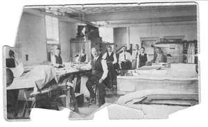
Despite the start of construction, a number of hurdles and difficult problems remained; changes in government resulted in a halt of work, the extension of Manitoba’s provincial boundaries northwards to Hudson's Bay, and the choice of the terminal. Before the end of 1912 the selection of the Nelson River as the port terminal was decided upon, and is then referred to as Port Nelson. By years’s end, the entire railway from The Pas to Port Nelson was under contract to J. D. McArthur. Fifty miles of roadbed had been graded from The Pas. The laying of rails was awaiting the Saskatchewan River bridge which was completed by spring 1913. The picture in this section supplied by David Malaher shows the “Hudson’s Bay Railway Drawing Office Staff 20th July 1916”. William Barnett is 5th from the left. Prominent in the middle is an individual with the name Murray.
By the end of the 1913 season 110 miles of steel had been laid. At the end of 1914 rails had reached Mile 214 from The Pas and work was underway on the steel bridge across the Nelson at Manitou Rapids. Beyond Manitou, the grade was complete to the second crossing of the Nelson River at Kettle Rapids near Gillam (Mile 332) only 92 miles from the Hudson Bay. The plan was to complete the work by the summer of 1916, but the outbreak of WW1 delayed the projected date to the fall of 1917. The schedule was plagued by labour shortages and a fire that destroyed the contractor’s tram-laying outfit.
Major J. L. Charles, Q.C., D.S.O., LLD., P Eng. was engaged in the preliminary surveys, design, and construction until the end of 1915 until he left for the War. Charles and two others applied for leave when grading was completed for the season, and was measured, calculated and recorded, together with final maps and profiles. Trait, Mackenzie and Charles walked on the frozen grade some 150 miles to board a train to The Pas and on to Winnipeg. Resident Engineers were required to provide a transit and level at their own expense, costly items for new engineers. Major Charles left his on the job and they were safely stored.
A large percentage of embankment over muskegs was built from side borrow of inferior materials including peat. Track was laid after the embankment was frozen and the roadbed was strengthened the following summer by train-filling. The bridge across the Nelson River at Kettle Rapids, a major structure, was not scheduled until heavy materials and equipment could be moved forward by rail.

By 1917 the Hudson Bay route was in serious jeopardy. All railways except the Canadian Pacific became insolvent and under the circumstances the Bay route was allowed to languish. In 1917, except for some filling and ballasting, work came to a halt with the completion of the steel bridge over the Nelson River at Kettle Rapids. Grade was completed to Amery and clearing to Port Nelson. Much work remained at the new port terminal. The Dominion of Canada had spent $13.8 million on the railway and $6.3 million on Port Nelson.
Kettle Rapids to the Churchill River
In 1919, with insincere appropriations by Canada, 450,000 ties and 825 tons of rails, along with construction equipment were taken from the railway by Canadian National and used to improve western branch Lines. Promises to replace the materials were unfulfilled and the line was being reclaimed by the wilderness. The “Muskeg Special” did operate to Mile 214 for prospectors who's discoveries resulted in the Mandy, Flinflon and Sheritt-Gordon mines.
In 1922 the Department of Railways and Canals engaged engineer D. W. McLaughlin to estimate the cost of completing the Port Nelson terminal. His estimate was $20.5 million for a port that would still be inadequate and the usefulness for shipping grain was in doubt. Debate and lobbying by the On-to-the-Bay Association continued until, after changes in government in 1926, Mackenzie King’s cabinet approved a budget with its provision for the completion of the Hudson Bay Railway.
Engineers J. B. and J. W. Tyrell had suggested an alternate route to the mouth of the Churchill River in 1926. Railway Minister Dunning engaged Frederick Palmer, an English civil engineer to examine the ports. Palmer strongly recommended for a Churchill River port in August 1927 based on a cost estimate for a Nelson River port of $26 million compared to $8 million for a Churchill River port. The estimates favoured the Churchill port even after allowing $5 million for the extra miles of railway to Churchill. The most economical route was to follow the Hudson Bay line to Mile 356 at Amery and then north 150 miles to Churchill.
In the winter of 1927-28, Major J. Leslie Charles, the engineer in charge of location, went out ahead of the end of steel to locate the new line and work out alignment and profiles. Major Charles had a party of 25 men and 60 sled dogs. Operating for four months in temperatures far below zero, he returned with complete blue prints including a survey of the mouth of the Churchill River for the port. The region west of the Lowlands seemed at first a favourable location for the railway to Churchill. After inspecting it Charles ruled it out because of the greater distance, considerable curvature required as well as rise and fall. Furthermore many springs and seepage were observed exuding from the slopes which would cause glaciation and culverts, both dangerous and costly for a rail line. Therefore he decided to strike due north through the inhospitable “Land of Little Sticks” where only stunted spruce merged into the barrens.
CN decided that Charles’s work should be repeated under non-winter conditions. So Charles set out with Luke Clemens and two first nation guides in early September, sloughing through the muskegs, seldom dry below the knees and frequently wet to the waist. After a month of walking, Charles notified authorities that nothing had changed his mind about the route.

Upon returning, Mr. Charles was asked to carry out a formal survey of the route. In 1928 the roadbed was pushed northward. The track laying crew consisted of nearly 3000 men under the jurisdiction of Claude Johnson, an engineer of the Canadian National Railways. An endless chain of about 2000 wheelbarrows moved from a train at the end of the rails along planks to dump gravel along the line staked out by the surveyors. Between the gravel train and the end of the fill was the track laying crew. At the end of steel was the tracklayer, a car equipped with hoists and cranes. On one side an endless belt carried ties from freight cars and on the other side a similar belt brought forth rails. The new rails were spiked down and the rails were bolted together.
At the end of the 1928 season the engineers decided on a bold plan to complete the last 60 miles to Churchill. The gravel pits froze hard and by the same token, the muskeg surface froze. Although this surface was not smooth the surface was level enough and hard enough to support the tracklayer. By April 1, 1929 a railway without a roadbed had stretched the last 60 miles and reached Churchill. During the following summer, the gravel ballast was dumped under the track without the encumbrance of the track laying crew. The line opened for traffic on September 10, 1929.


Operations
In the end the Hudson Bay Railway never achieved what it was set out to accomplish. To this day it has been an uneconomic enterprise, never carrying enough tonnage to be sustainable. Only persistent lobbying on the part of western Manitoba and Saskatchewan grain shippers has kept it in operation. Today (2017) it’s future is in doubt as the grain terminal has been shut down. The railway mainly serves small communities and the town of Churchill with domestic freight shipments and tourists.
Miscellaneous

Many stories are available of the primitive methods employed in the surveys and construction of the railway. Major Charles recorded his exploits using dog teams and first nations for winter surveys. Other stories record the inhumane conditions the men toiled and lived in.
References
- Turmoil and Triumph: The Controversial Railway to Hudson Bay, Ian Bickle, 1995, Review by Paul Thistle, Manitoba Historical Society
- Manitoba History, Number 8, Autumn 1984, David Malaher P. Eng., Manitoba Historical Society
- The Manitoba Professional Engineer, June 1992, Manitoba Mourns the Passing of Major John Leslie Charles, O.C., D.S.O., LL.D., P.Eng.
- Wikipedia, Hudson’s Bay Railway (1910)