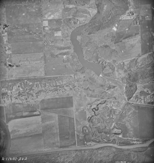
File:Minnedosa River Hydroelectric Site Aerial Photograph 1947.png.jpg
From EGM Heritage
No higher resolution available.
Minnedosa_River_Hydroelectric_Site_Aerial_Photograph_1947.png.jpg (520 × 549 pixels, file size: 41 KB, MIME type: image/jpeg)
4. This information comes from an online reference maintained by the University of Brandon. The late Dr. John Welsted (Department of Geography, Brandon University) assembled a collection of remotely sensed images that depict the geography of Manitoba. About 550 of these images have been selected for presentation in an electronic book (e-book) titled Manitoba from the Air: A Geographical Interpretation. http://mbair.brandonu.ca/figure/display/16.25
File history
Click on a date/time to view the file as it appeared at that time.
| Date/Time | Thumbnail | Dimensions | User | Comment | |
|---|---|---|---|---|---|
| current | 20:46, 15 April 2013 | | 520 × 549 (41 KB) | Gcook (talk | contribs) | 4. This information comes from an online reference maintained by the University of Brandon. The late Dr. John Welsted (Department of Geography, Brandon University) assembled a collection of remotely sensed images that depict the geography of Manitoba.... |
You cannot overwrite this file.
File usage
The following page uses this file: